Map pin icon
Ålesund

Hike to Mt. Storhornet on Godøya

On Godøya by Ålesund, Storhornet offers a beautiful combination of sea and mountains.
From
8300
NOK
Duration
5h
Medium
From
8300
NOK
map pin icon
Ålesund

Fjelltur til Storhornet

What awaits you

  • 360° views over the Atlantic Ocean, Ålesund and the Sunnmøre Alps
  • Start at Alnes lighthouse with a detour to the Johan Skytt rock
  • Local guide – suits both beginners and experienced hikers

Join a guided hike to Storhornet (497 m) on Godøya, just outside Ålesund. Starting at Alnes lighthouse, the 5-hour hike covers about 8 km round trip and 650 metres of climbing. From the top you get a 360° panorama over the Atlantic Ocean, Ålesund and the Sunnmøre Alps. Suitable for beginners and experienced hikers, May to September.

Read more

Coast and mountains on Godøya

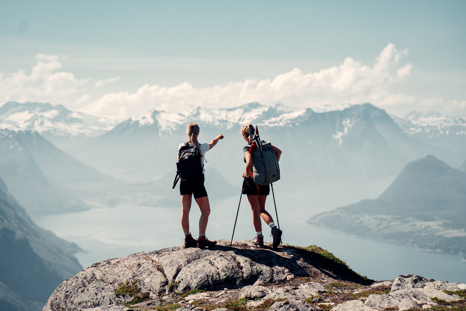
Located on Godøya, an island outside Ålesund, Storhornet offers a beautiful hike combining maritime and alpine feelings. After a superb hike, you'll be rewarded with a stunning 360° panorama over the Atlantic Ocean, Ålesund and the Sunnmøre Alps.

From Alnes lighthouse to the summit

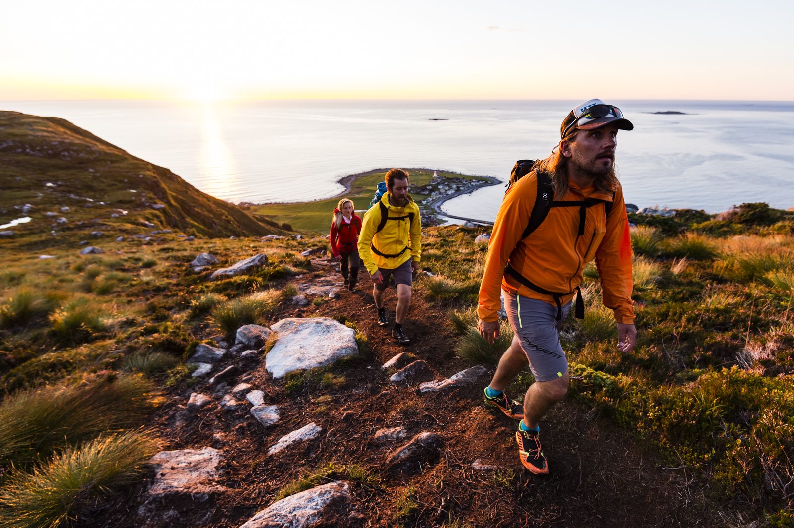
We start hiking from Alnes lighthouse, a beautifully located lighthouse. After reaching the first ridge, we follow along the north side of Alnesvatnet. Before we make the last push towards the summit, we take a short detour to Johan Skytt, a rock stretching out over the edge. From here we follow the trail up to the summit.

A rest with a view

While you're enjoying a well-deserved rest, soaking in the views, it will be easy to understand why this is one of our favourite hikes around Ålesund.

Facts about the hike

  • Perfect tour for both beginners and experts
  • Elevation: 497 metres / 1630 feet
  • Climb: 650 metres / 2132 feet
  • Distance: 8 kilometres (round trip)

Other hiking options

If you are keen on hiking something different, you can always contact us for a custom trip to Molladalen, Vardane or other destinations you're interested in.

Highlights

From lighthouse to mountain
The hike starts at Alnes lighthouse. After reaching the first ridge, we follow the north side of Alnesvatnet before the last push towards the summit.

Detour to Johan Skytt
On the way we take a short detour to Johan Skytt, a rock stretching out over the edge of the mountainside.

360° views from the summit
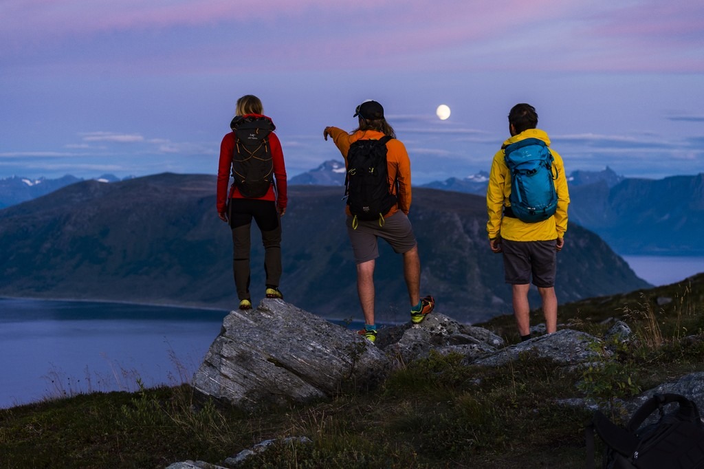
At the 497-metre summit we rest and take in the views over the Atlantic Ocean, Ålesund and the Sunnmøre Alps.

Local guide
A guide with local knowledge leads the way. With 8 km round trip and 650 metres of climbing, the hike suits both beginners and experts.
Show more photos

Practical information

Included

  • Guide with local knowledge

Addition

  • Outdoor clothing suitable for hiking
  • Water-repellent or windstopper jacket
  • Waterproof hiking boots
  • Wool underwear and socks
  • Mid-layer – fleece or wool
  • Hat and gloves
  • Backpack – 10–20 litres
  • Bottle of water
  • Small snack
  • Camera

Requirements

  • Difficulty: medium (8 km round trip and 650 metres of climbing)

You are required to read our safety rules and submit a self-declaration form to participate in our courses and trips. Read our safety rules here.
Safely led by qualified guides

“We love showing off the mountains we grew up with – and finding the hike that suits you best.”
The Mountain Guides at Uteguiden

Local Guides
Our guides are experienced and know the mountains, trails and stories of the area. Along the way they share tales of the landscape, the mountain farms and life by the fjords.

Safe in the Mountains
Your guide assesses the weather and conditions before and during the hike, and adjusts the route – or turns back – when it isn't safe to continue.

Well Prepared
Before the hike you'll know exactly what to bring, and your guide carries first aid and safety equipment, so you can focus on the hike and the views.

Your Pace
Many of our hikes are private, with your own guide for you and your group. The pace is adapted to you, so everyone has time to enjoy the experience.

Frequently asked questions (FAQ)

What time of year can I do the Storhornet hike?

The hike to Storhornet runs in the season from May to September. It takes about five hours, starts from Alnes on Godøya and is led by a guide with local knowledge.

Where do we meet, and how long does the hike take?

The meeting point is Alnes on Godøya, an island just outside Ålesund. We start hiking from Alnes lighthouse. The hike takes about five hours and is around 8 km round trip.

How hard is the hike – will I make it all the way to the top?

The difficulty is medium, and the hike suits both beginners and experienced hikers. It is about 8 km round trip with roughly 650 meters of climb, and the summit is at 497 meters. We take a well-deserved rest at the top.

How much does it cost, and how many people can join?

You can see the price at the top of the page and in the booking window at the bottom right. The price may vary with the number of participants, age and other options. For private tours and groups we offer a fixed price for the group – get in touch and we will help you. There can be 1–8 participants. Everyone must read our safety rules and sign the safety waiver before taking part.

Do you offer other hikes from Ålesund, for example to Molladalen?

Yes, you are welcome to contact us for a custom trip to Molladalen, Vardane or other destinations you are interested in. Storhornet on Godøya is one of our favorite hikes around Ålesund.